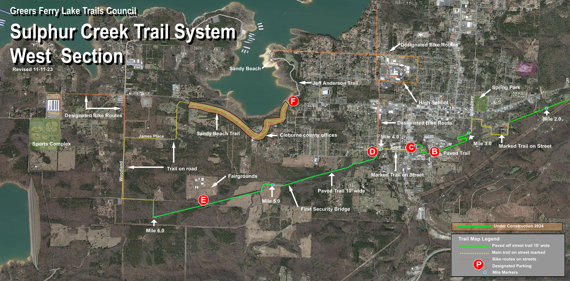

Parking Areas
Numbers correspond to red circle markers on the above map:
B. South Broadway St. - directions
C. 701 South 7th St behind Trailhead Wheels - directions
D. 11th and Scott Street directions
E. Fairgrounds Bittle Road - directions
F. West Main Street - directions

Mile Marker 3 to S 7th
- Easy
- Asphalt
- ADA-compliant
- Two bridges

Mile Marker 4 to 5
- Easy
- Asphalt
- ADA-compliant
- The First Security metal pedestrian bridge

Mile Marker 5 to 6
- Easy
- Asphalt
- ADA-compliant
- Two bridges

Mile 6 to W Main Parking at "E"
Follow the "sharrows" (share the road markings) and share the road signs along Bittle Rd, Woodland Rd, and James Place to access Sandy Beach trail and Jeff Anderson Memorial Trail.
Designated Bike Routes
To the west - From Woodland and James Place, head north along Woodland, following the sharrows and share the road signs to Hwy 110 to access the sports complex.
To the northeast - From Parking Area C, go north on S 11th and follow the sharrows and share the road signs to the Heber Springs public school buildings and to Sandy Beach.